|
|
 |
|
|
 |
Radiosonde data from the Atmospheric Chemistry Group field projects are available in two main formats. The raw data are available as a compressed file (in either tar-gzip, or pkzip compression) that when decompressed contains one ASCII file per profile of the raw data from the sounding. Each data set also contains a index, or a read-me file that gives the starting positions and starting or nominal time/date of launch.
The netCDF format contains data that has been interpolated onto a standard,
125m vertical grid. The interpolation involved fitting all data points
within a 250m interval to a second degree polynomial, and solving for the
fitted value at the even 125m center altitude. The netCDF files are used
by this web server to generated the contour plots 'on-the-fly'. The netCDF
format is explained in great detail at the netCDF
homepage.
Please Note: Starting with the NEAQS 2004 project the radiosonde data have
been interpolated onto a standard 50 meter grid.
Each project contains raw data in one tar-gzip and one pkzip file (both contain identical data sets. Each project also includes one or more netCDF files. Each project has at a minimum one netCDF file with altitude and time axes. Some of the projects had sections that went predominately North-South; for these a netCDF file with altitude and latitude as the axes may be available.
Please note: In Netscape or Internet Explorer you may "shift" click or "right click" to download the file (link) to your local disk.
| ASCII raw data, tar.gzip compressed | ASCII raw data, pkzip compressed | netCDF |
|---|---|---|
| |
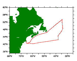
NAAMES3_rsond.zip | NAAMES3_rsond_all.cdf |
U.S.Dept of Commerce / NOAA / OAR / PMEL / Atmospheric Chemistry